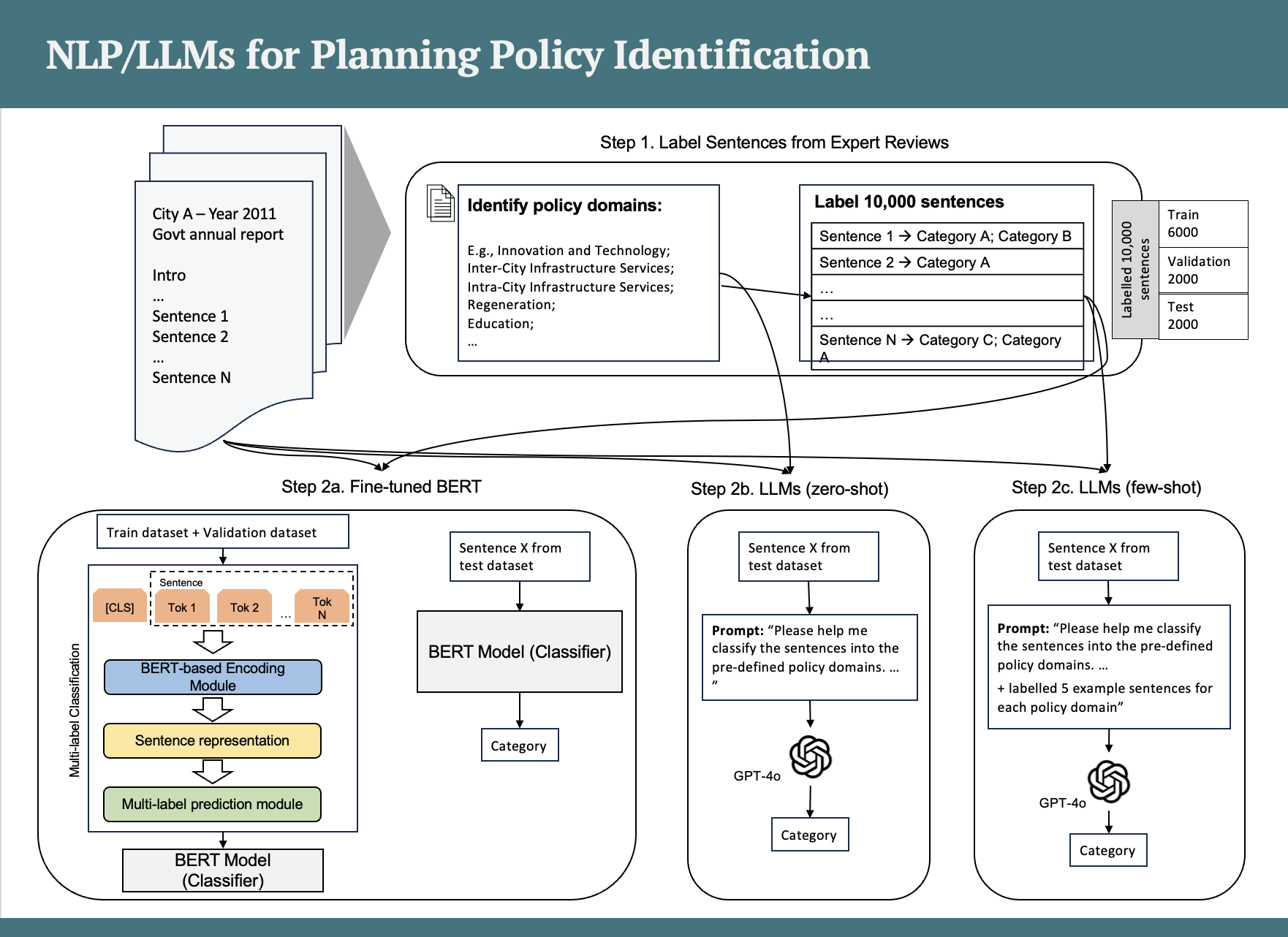
CITY-LEVEL DIGITAL TWINS
From urban modelling to city digital twins – Reflections from the applied urban modelling (AUM) symposia
Published on Environment and Planning B: Urban Analytics and City Science, 2024
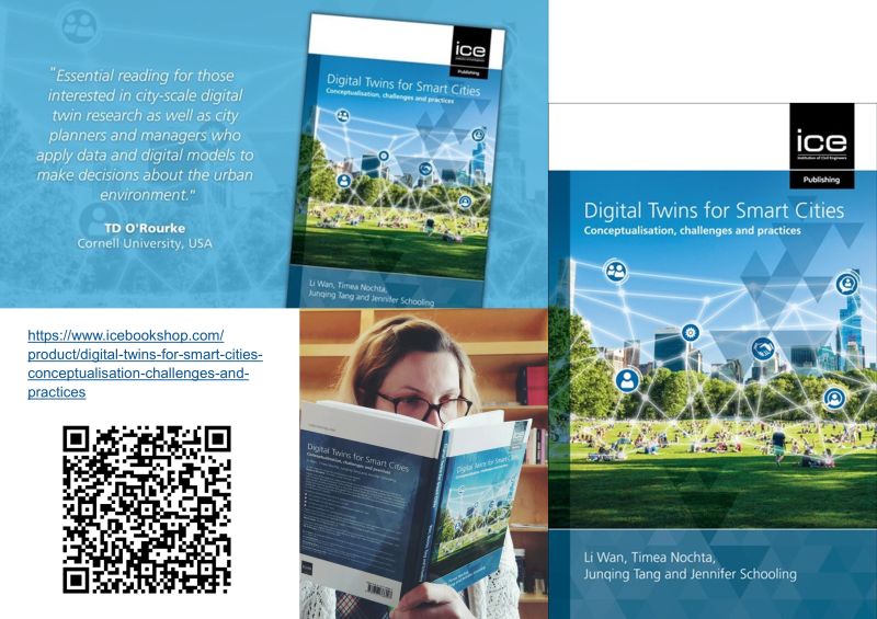
Conceptualising city digital twins (CDTs)
Digital Twins for Smart Cities: Conceptualisation, challenges and practices,2023
Case studies: City-scale digital twins
Digital Twins for Smart Cities: Conceptualisation, challenges and practices,2023
A social construction of technology view for understanding the delivery of city-scale digital twins
Published on ISPRS Annals of Photogrammetry, Remote Sensing & Spatial Information Sciences,2022
Digital twin implementations at the regional and city levels
Digital Twins in the Built Environment: Fundamentals, principles and applications,2022
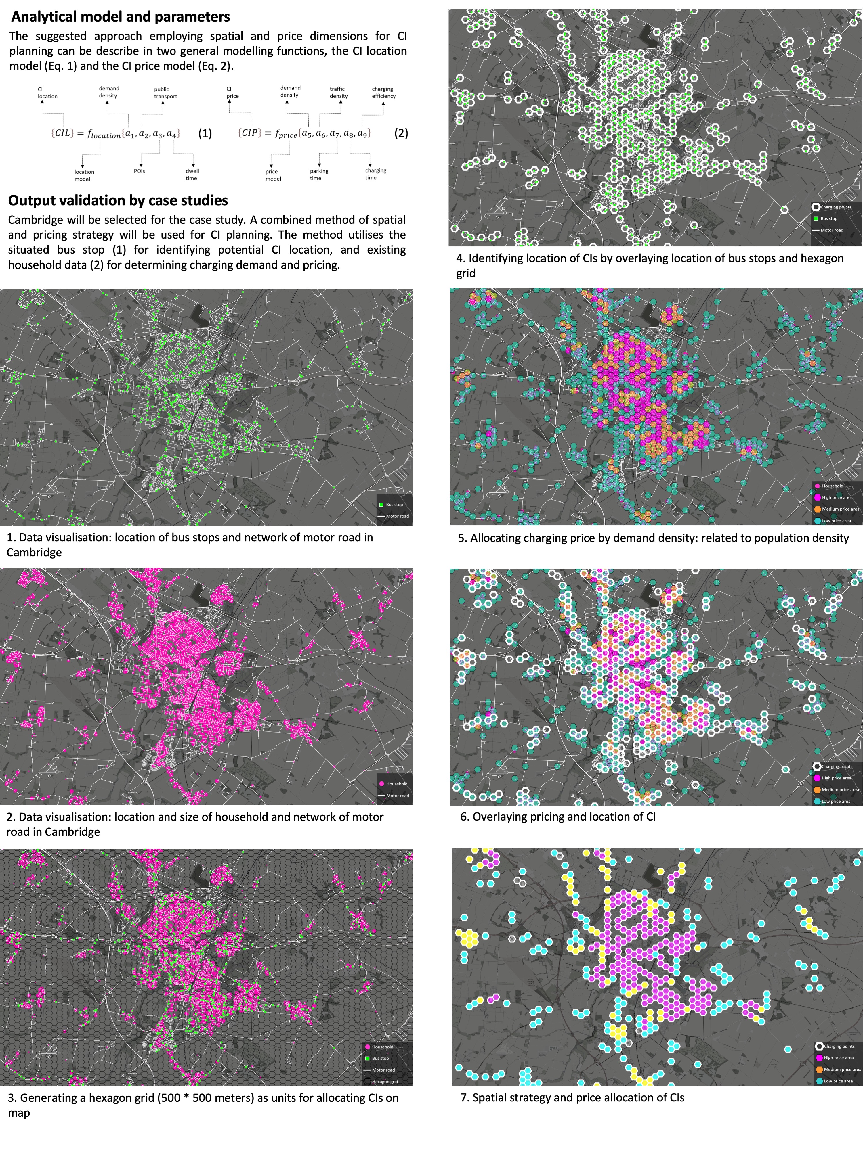
City-level digital twin for strategic planning – Learnings from Cambridge
Presentation for the Data for Policy 2021 Conference, 2021
A socio-technical perspective on urban analytics: The case of city-scale digital twins
Published on Journal of Urban Technology, 2020
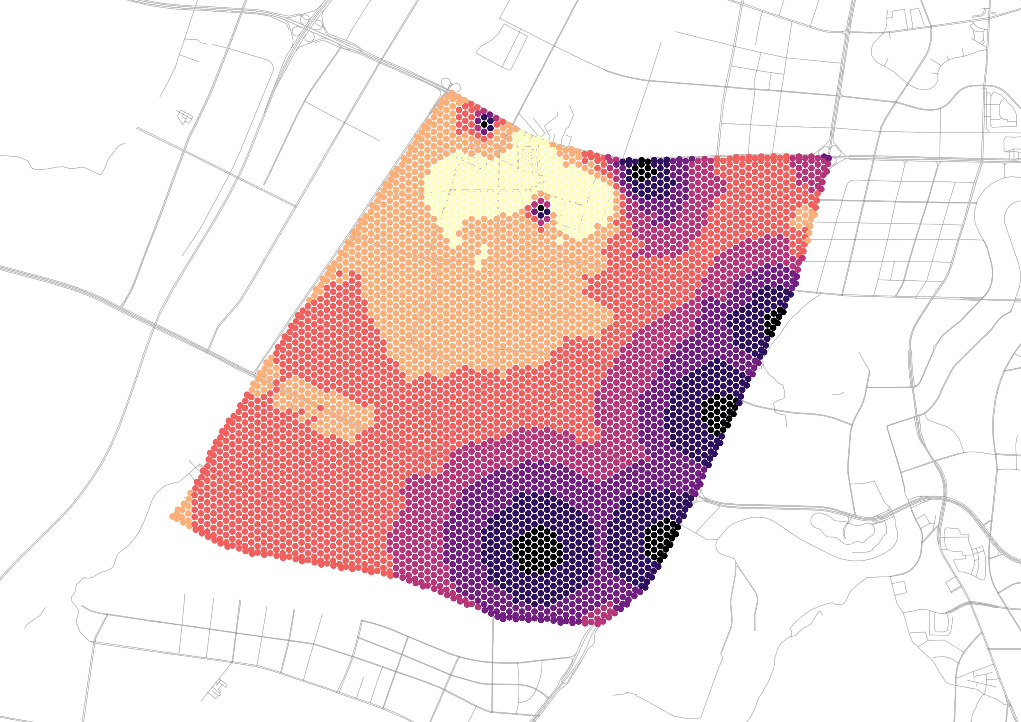
Exploring resilient observability in traffic-monitoring sensor networks: A Study of spatial–temporal vehicle patterns
Published on ISPRS International Journal of Geo-Information, 2020
Digital twins give urban planners virtual edge
Financial Times article, 2020
Developing a city-level digital twin - Propositions and a case study
Published on International Conference on Smart Infrastructure and Construction, 2019
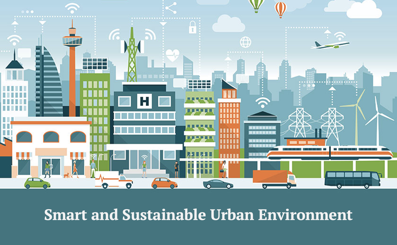
DIGITAL AND SMART CITIES
Smart and sustainable urban environment
Routledge Handbook of Smart Built Environment, 2025
Leadership of urban digital innovation for public value: A competency framework
IET Smart Cities, 2023
Leadership for responsible digital innovation in the built environment: A socio-technical review for re-establishing competencies
Published on Journal of Urban Management, 2023
The conundrum in smart city governance: Interoperability and compatibility in an ever-growing ecosystem of digital twins
Published online by Cambridge University Press, 2023
Automatic number plate recognition (ANPR) in smart cities: A systematic review on technological advancements and application cases
Published on Cities, 2022
Confusion of goals — Rethinking the implication of data analytics and modelling for urban planning and design industry
Published on Landscape Architecture Frontiers, 2020
Digitalisation for smarter cities: moving from a static to a dynamic view
Published on Proceedings of the Institution of Civil Engineers - Smart Infrastructure and Construction, 2019
UNDERSTANDING JOURNEYS TO WORK
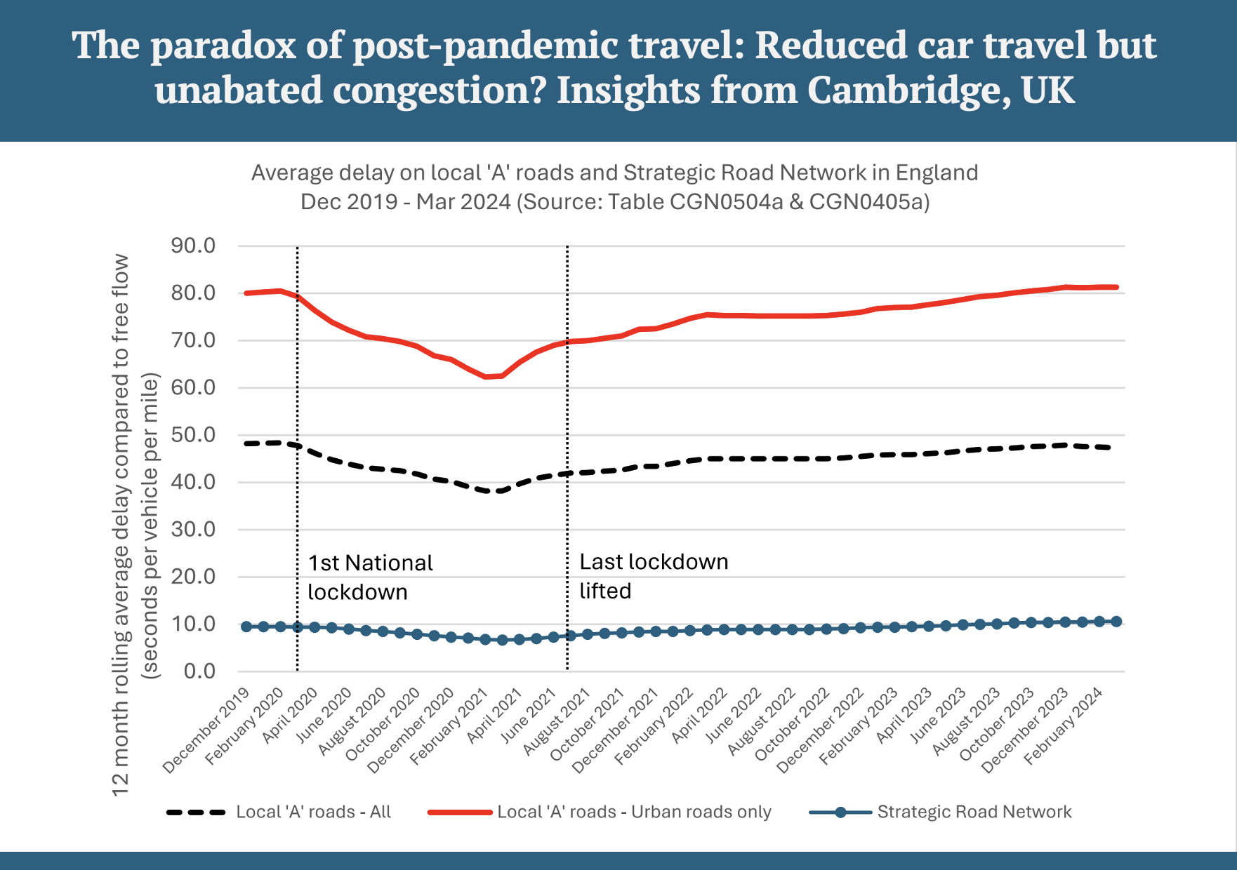
The paradox of post-pandemic travel: Reduced car travel but unabated congestion? Insights from Cambridge, UK
Published on Travel Behaviour and Society, 2025
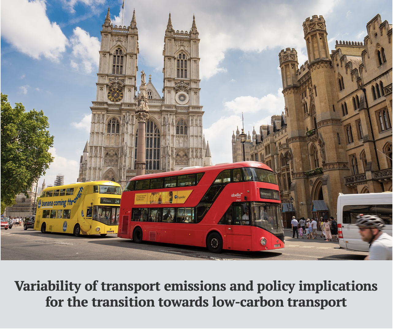
Variability of transport emissions and policy implications for the transition towards low-carbon transport
Published on International Journal of Urban Sciences, 2025
Inferring trip purposes and mode substitution effect of rental e-scooters in London
Published on Transportation Research Part D: Transport and Environment, 2024
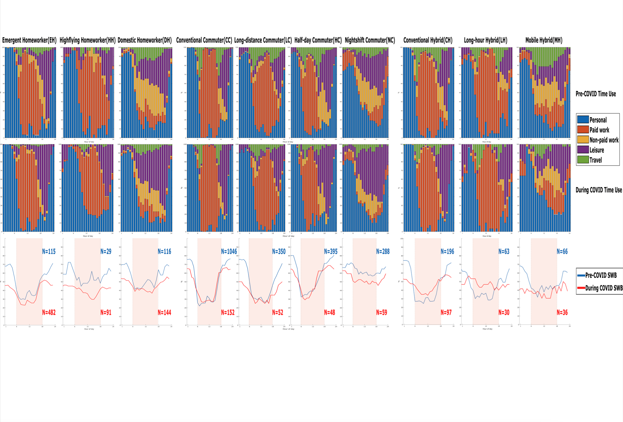
Remote working and experiential wellbeing: A latent lifestyle perspective using UK time use survey before and during COVID-19
Published on Plos One, 2024
Modeling emission reduction benefits of the premium point-to-point bus service in Metropolitan Manila, Philippines–a scenario analysis
Published on International Journal of Sustainable Transportation, 2023
Estimating commuting matrix and error mitigation – A complementary use of aggregate travel survey, location-based big data and discrete choice models
Published on Travel Behaviour and Society, 2021
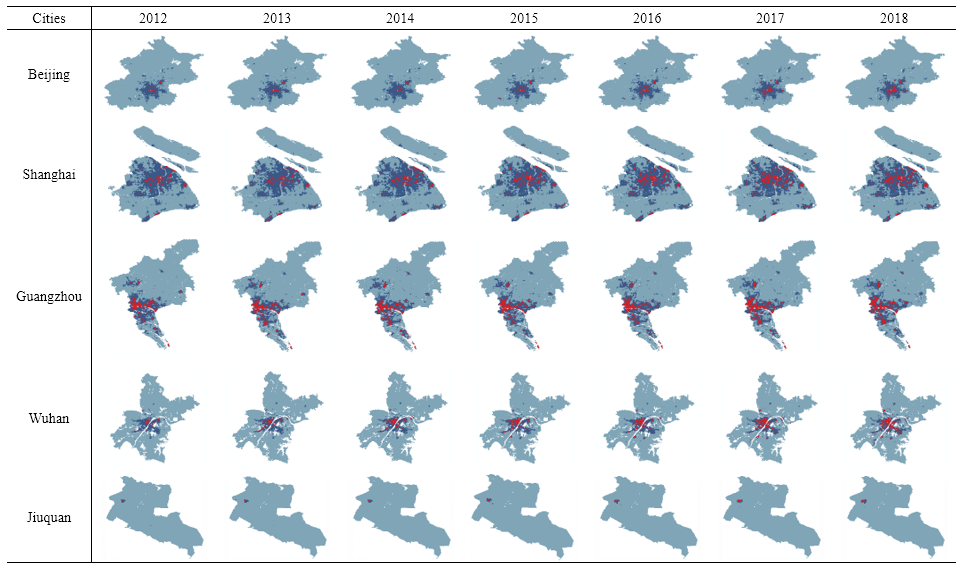
Understanding non-commuting travel demand of car commuters – Insights from ANPR trip chain data in Cambridge
Published on Transport Policy, 2021
Big data and urban system model – substitutes or complements? A case study of modelling commuting patterns in Beijing
Published on Computers, Environment and Urban Systems, 2017
SPATIAL EQUILIBRIUM MODELLING
Understanding the spatial impact of COVID-19: New insights from Beijing after one year into post-lockdown recovery
Lincoln Institute Working Paper, 2022
UK2070 Futures: Post-covid scenario modelling
For the UK2070 Commission, 2020
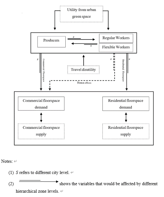
Assessment of model validation outcomes of a new recursive spatial equilibrium model for the Greater Beijing
Published on Environment and Planning B: Urban Analytics and City Science, 2019
Environmental impacts of transformative land use and transport developments in the Greater Beijing Region: Insights from a new dynamic spatial equilibrium model.
Published on Transportation Research Part D: Transport and Environment, 2017
ECONOMIC GEOGRAPHY
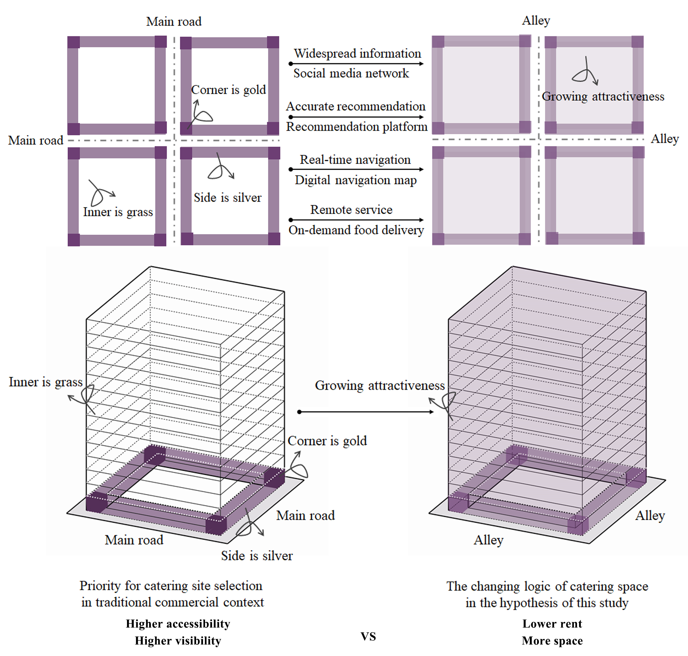
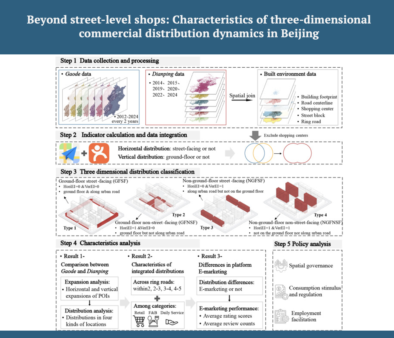
Beyond street-level shops: Characteristics of three-dimensional commercial distribution dynamics in Beijing combining Gaode and Dianping data
Cities, 2025
The post-covid city
Published on Cambridge Journal of Regions, Economy and Society, 2022
Monitoring spatial changes in manufacturing firms in Seoul metropolitan area using firm life cycle and locational factors
Published on Sustainability, 2019
Identifying the growth patterns of high-tech manufacturing industry across Seoul metropolitan area using latent class analysis
Published on Journal of Urban Planning and Development, ASCE, 2017